Notes of 8a&c, Social Science ss 8 chptr 6 rdg maps.pdf - Study Material
Page 1 :
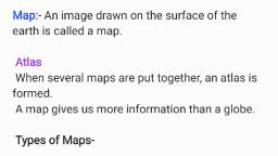
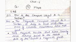
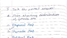
STUDY NOTE, STD:8 UNIT:6, READING MAPS, 1.Name the branch of science which make maps?, ➢ Cartography, 2.One who makes maps is known as..................., ➢ Cartographer, 3.Different types of maps are used for different purposes. Make a table about them, Types of maps, , Purposes, , •, , Political map, , •, , For understanding the political, boundaries, , •, , Military map, , •, , For military purposes., , •, , Historical map, , •, , For the study of history., , •, , Astronomical map, , •, , For the study of celestial bodies., , •, , Landuse map, , •, , For understanding the land use., , •, , Weather map, , •, , For meteorological studies, , •, , Physiography map, , •, , For understanding earth's features, , •, , Natural vegetation map, , •, , For understanding different types of, Natural vegetation, , 4.Write a list of maps familiar to you, ➢ World-Political Map, World-Physical, ➢ India-Political Map, India-Physical, ➢ Kerala-Political Map, Kerala-Physical, 5.What might happen if both soil types and physiography are incorporated in the same map?, ➢ Including different information in the same map will create confusion in reading it., 6.What is thematic maps?, ➢ Maps depicting specific themes are known as thematic maps., 7.Based on function, maps can be classified into two. Which are they?Write its features, ➢ Physical maps-Maps representing natural features are called physical maps, ➢ Eg: Physiography Maps, Climatic Maps, etc., ➢ Cultural maps-Maps representing man-made features are called cultural maps, ➢ Eg: Agricultural map, Industrial map, 8.Maps are generally classified based on two factors.Which are they?, ➢ Based on function, ➢ Based on scale, , visit www.shenischool.in or whatsapp 7012498606, To join our telegram group https://t.me/Shenibloggroup
Page 2 :
9.Make a flow chart by classifying the below mentioned maps based on function., • Political map, • Agricultural map, • Soil map, • Industrial map, • Climatic map, • Natural vegetation map, • Astronomical map, • Military map, • Weather map, • Landuse map, • Physiography map, • Historical map, , ➢, , Maps, , Cultural maps, , Physical maps, , Political map, Agricultural map, Industrial map, Military map, Landuse map, Historical map, , Soil map, Climatic map, Natural vegetation map, Astronomical map, Weather map, Physiography map, 10.How maps are classified based on the scales?, , Maps, , Small scale maps, Maps showing only the, Important, information of larger areas, Eg:Atlas maps,, Wall maps, , Large scale maps, Maps representing detailed, information of a small area, Eg:Cadastral maps,, Topographical maps, , visit www.shenischool.in or whatsapp 7012498606, To join our telegram group https://t.me/Shenibloggroup
Page 3 :
11.What are Cadastral maps?, ➢ Cadastral maps are prepared to record the boundaries and ownership details of land, properties, ➢ Eg: Village maps, 12.Define Topographical maps, ➢ Maps that show both natural and man-made features in detail., 13.What are the factors required for the good reading of maps?, ➢ Map reading requires a good knowledge of its scale, direction, and the signs and symbols, used in them., 14.What are the three different methods to show the scale in maps?, ➢ Statement of scale, Representative fraction, and Linear scale., 15.Which among the scales given in the map is easy for us to, Understand? Why?, ➢ Statement of scale, ➢ Even a layman can easily understand this., ➢ Eg:1 cm to 5 km (one centimetre on the map represents 5 km on earth), 16.Can the people of other countries interpret the maps prepared on Indian units with ease? Why?, How will you avoid this problem?, ➢ No., ➢ The units used for measuring distance are different in different countries., ➢ Representative fraction is the ratio between the map distance and corresponding ground, distance expressed in fractional form., ➢ This proportionate distance can be read in accordance with the units followed in each, country, ➢ Eg:1:500000 (While the Indians read this as 1 centimetre to 500000 centimetres, the, Europeans can read this as 1 inch to 500000 inches), 17.What is the merit of using linear scale in maps?, ➢ When a map is subjected to enlargement or reduction, the linear scale will also change, accordingly. This is the merit of this method., 18.How to measure distances on maps?, ➢ To measure straight distance, a ruler can be used., ➢ If it is a curved distance such as a river or a curved path, first measure the distance using a, thread and then measure the length of the thread, 19.What should be done to find the actual distances?, ➢ The map distance should be multiplied with the proportionate ground distance shown in the, map scale, ➢ Eg: Scale of the map is 1cm to 10km. Suppose the distance from A to B in the map is 5 cm., ➢ Then the actual distance from A to B = 5 x10km =50km, 20.Name the agency responsible for making, scrutinising, and, publishing maps in our country.
Page 4 :
➢ The Survey of India, 21.Show the symbols used for easy identification of directions in maps, , 22.Use the indicator of direction as shown in the following map identify the location of the cities, in the map, , City, , Direction, , •, , Srinagar, , •, , North, , •, , Thiruvananthapuram, , •, , South, , •, , Kolkata, , •, , East, , •, , Gujarat, , •, , West, , •, , Lucknow, , •, , Northeast, , •, , Visakhapatnam, , •, , Southeast, , •, , Jaipur, , •, , Northwest, , •, , Panaji, , •, , Southwest, , 23. Why internationally accepted signs and symbols are used for making maps?, , visit www.shenischool.in or whatsapp 7012498606, To join our telegram group https://t.me/Shenibloggroup
Page 5 :
➢ Map reading will be confusing if different countries use different signs and symbols for, map making. That is why internationally accepted signs and symbols are used for making, maps., 24.Make a table showing the conventional signs and symbols used in maps, , Conventional signs and symbols, , PO, PS, , Features, •, , Metalled road, , •, , Railway line, , •, , Stream, , •, , River, , •, , Church, , •, , Temple, , •, , Mosque, , •, , Settlement, , •, , Post Office, Police Station, , •, , Well, , •, , Fort, , •, , Bridge, , •, , Pond, , •, , Graveyard, , •, , Tube well, , 25.Colours used in maps-Table, , Colours, , Features, , •, , Green, , •, , Natural vegetation, , •, , Yellow, , •, , Farmland, , •, , Red, , •, , Settlements, roads, , •, , Black, , •, •, , Railway line, latitudes and longitudes,, telephone lines, , •, , Blue, , •, , Water bodies, , •, , Brown, , •, , Rock outcrops, sand dunes, hills, , visit www.shenischool.in or whatsapp 7012498606, To join our telegram group https://t.me/Shenibloggroup
 Learn better on this topic