Page 1 :
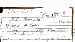
Sociat Science-VIll (M.P.) 227, , Text Book Exercise, , Very Short Answer Type Questions, , Q. 1. In which hemisphere Antarctica is located?, , Ans. Antarctica lies completely in the Southern Hemisphere with the, South Pole almost in its centre., , Q. 2. What is the place of Antarctica in size in the.world?, , Ans. In size, it is the fifth largest continent., , Q. 3. What is a iceberg?, , Ans. A large mass of ice floating in the sea. It is at least five metres, high above the sea level. \, , Q. 4. What is ice cap?, , Ans. An area of a few square kilometres which is covered with snow, and ice permanently is called ice caps., , Q. 5. What is a Krill? ‘, Ans. Krill is a fish found in Antarctica. Krills are very smaller fish., , They are found in swarms which are the food of whale, real, penguins and, birds. They provide a variety of products such as fish meat, krill meat paste, , and krill protein., , Short Answer Type Questions, , Q. 1. Describe about the exploration of Antarctica continent., , Ans. The mainland of Antarctica Continent firs discovered in 1820 but, real exploration began only in the Twenties century. After captain Cook, one by one travellers went in rea.® of this snow filled continent and many, teams among them wire buried under the sheet of ice. Captain Robert Falcon, Scot of British Navy was successful. He left for Antarctica in 1910 with, his team and réached there in 1912 but there he found the flag of Norway, which was hoisted by first Norwegian traveller Roald Ama:.sen who had, reached there on 20 Oct.1911. The India has also sent team of scientists to, this continent, The Indian team has explored a sea mountain. —, , Q. 2. Describe the physical structure of Antarctica., , Ans. About ninety-eight percent of Antarctica is permanently covered, by ice. It has an average thickness of two to five kilometres.A Greater part, of Antarctica is rugged and mountainous. Shores are steep. Queen Maud, Range divides the continent in almost two halves. Mt. Erebus a live volcano, is the most picturesque land-mark on the continent., , Q. 3 Why Antarctica is called the White Continent?, , Ans. It is the only continent in the world, which remains completely, frozen throughout the year. An endless white sheet of ice covers the, continent hence it is also known as the white continent., , Q. 4. Write about the resources of Antarctica.
Page 2 :
228 Sociat Science-VIIl (M.P), , Ans. The land surface in Antarctica is mostly barren and is very cold, desert, The sca is very generous and bountiful, Penguins, the sca birds ang, seals are abundant. Whales are also found here. The international law, prohibits killing of these sca animals on large scale to preserve the, environment. A small fish called Krill is found in swarns extending upto, 100 metres or more. They may provide a varicty of products such as fish, meat. Krill is full of protein and is also used as meat paste, , It is believed that precious animals are hidden below the surface of ice, sheet in Antarctica deposits of coal, iron ore and copper have been found, but duc to severe hindrance there minerals have been not utilized till today., , Long Answer Type Questions, , Q. 1. Describing the vegetation and life of Antarctica explain why, people cannot lives permanently here?, , Ans, The land surface is mostly barren and is very cold. The paucity, of sun rays creates hurdles in growth in trees so there is little vegetation, here and the areca where vegetation grow in few weeks of summer. Lichens,, watergrass and fungus are the vegetation here. There are over 200 spccies, of lichens in this continent. The insects on the land.are minute invertebrate, but sea is bountiful. Penguins, blue whales, scal, albastross and Krill fish, the prominently found. Antarctica is the most coldest and isolated continent, The fast ice winds blow and there is ice everywhere. In such harsh climate, life is impossible so the human beings cannot live here permanetly, , Q. 2. Why Antarctica is called the dedicated continent for science?, Write about the camps established by Indian in Antarctica., , Ans, Though Antarctica is a vast size but it has little offer by way of, material resources but it provides unique opportunities to scientists to learn, more about the carth. This continent, therefore. is also called a continent, dedicated for science. People have created liveable environments whether, the stations established by them., , Since 1982 to 2006 Indian scicntists have been visiting Antarctica, continent They have established a unmanned permanent base camp, ‘Dakshin Gangotri” for this purpose in 1992. Indian scientists have also, explored a sea mountain during their visit and they have named it ‘Indra’, In 1988-89 the VIflth Indian team established a manned friendship camp., 70 km far from ‘Dakshin Gangotri’., , , , (Additional Imnartant Quectiane )
Page 3 :
26. Study of Local Map, oa, , Text Book Exercise, , Very Short Answer Type Questions, , Q. 1. Which are the three main landforms of surface? Ans. Mountains, Plains and Plateaus are the major landforms., Q. 2. Which are the two methods to show the landform?, Ans. There are two methods to show the landforms, , (1) Colour method . (2) Contours method., , Q. 3. What are contour lines?, Ans. Contour: A contour is an imaginary line drawn on a map which, joins the points of the same height above sea-level. Contrours are the most, accurate and common form of showing the landforms., , Q. 4. In what colours plain, platform and mountain are shown. ina, map?. . :, ‘Ans. Plains are shown in green colour, Dark green colour shows the, high plains. The high rising places are shown in yellow colour, while the, colour of high plateau is grey. The low height mountains is of dark grey or, light brown colours and the high mountains are shown with the darkbrown, , colour., Q. 5. Show the conical hill and plateau through contour lines., , , , , , , , , , , , , , , , , , , , , , , , , , , , , , , , —\, ~ A 5, , IW > 4 Yt, , 1 ', , a) Vit, hive tn 7., , Vit muy, , tin vita, , ho ud, , hit wud, , yeu vit, , a vile, , tin rele, 160 & +160 45 iia 4000, ~ 140 1149 2000 2000, - 120 0 1000, 100 100 0 i, , , , , , , , Conical hills Plateau
Page 4 :
232 Sociat Science-VIIl (M.P), , Ans. Conical hills: The contour lines are also of equal distance and, equal round. If you see such contour lines in the map you will easily know, , that this is conical hill., Plateau: The top of plateau is more or, , few contours but its sides are steep and they, , contours on a map., Q. 6. What do the light blue and dark blue colours indicate?, , Ans. Depth of sea is shown by various shades. The sea is shown in, map by blue colour, sea nearby land surface is shown by light blue colour., As the depth of sea increases the blue colour becomes darker. The deep, , and trenches of sea is indicated by the very dark blue colour., , Project Work, , less flat is represented by very, are shown by closely spaced, , neal than dicence with
Page 5 :
Soctat Science-VIll (M.P.), , Additi, 0, nal Important Questi, 2 1. What is a map? =, ns. A map is the re; “ i, e, Leen ee Presentation of earth or a part of the earth of, 2 2. bi is use of a map? ie, ns. It helps us in locati :, A dyaedetea eae ating and identifying various fractures of the, , . 3. Which directi, o2 ee a ection show the top of the map?, P map shows ‘North’ directi, Q. 4. What are the two methods of spar, Which colours are used'to show the land ae jandioetts i, Ans. By colours and contours are shi ee, colour is used to show plains yellow . ks landforms on the map. Green, grey for low hills and brown for high Sie ee, i 5. re the landforms. are shown by cintonra? pe, ns. Various landforms, slo ii i ", contours on the map. Contours ae <i 3, join the points of the same height above the sea level. Each en ee, mentioned with its height. The closeness or distance of contour lines ho ‘, the slope of that land. When the contours are closely drawn on rs eo., The slopes will be steep and when they are apart the slope will be gentle., . The contours patterns on this map gives us an index about shape of smallest, relief features on the earth’s surface., Q. 6. How is a plain represented on a map with the help of contours?, Ans. Widely spaced contours depict a plain on the map., Q. 7. Distinguish between:, (i)’ Maps made on large and small scales., (ii) A plateau and a plain., Ans. (i) Maps made on large and small scales., , Map made on large scale Maps made on small scale, , The maps drawn on large scale, are called large scale map., , 1. The maps drawn on small, scales are called small scaled], maps. :, , 2 These maps do not show a larg, number of details, , 3. These maps show bigger area, World and country maps at, drawn on small scales., , ', These maps show a large number, , _ of details., These maps usual; show an small, , _ area with minute details.