Page 1 :
r is found as ice sheets in glaciers. It is found, lowing water in the oceans, rivers, lakes, ponds, underground streams. It is also found as water, spour in the atmosphere., , total amount of water on the Earth’s surface is, ated to be about 1,250 million cubic km. Most, , total amount of water present on the Earth is, d and it is approximately the same as it was, , Hydrological Cycle, , ater is stored in natural reservoirs such as the, mosphere, oceans, lakes, rivers, soils, glaciers,, , The Hydrological Cycle, , cee |, , Hydrological cycle, , AT ema ee, , ater is a very significant resource on the Earth. It is a unique feature of our planet. It is, ential for human beings, plants and animals., , , , snowfields and groundwater. Water continuously, changes its form and circulates between oceans,, atmosphere and land. This cyclic movement of, water is known as the water or hydrological cycle., The water cycle consists of three main parts :, evaporation, condensation and precipitation., , Evaporation is the process in which water gets, converted into water vapours due to the heat of the, sun,, , Through the process of evaporation, much of water, from the oceans and land enters into the, atmosphere in the form of water vapours., , Evapotranspiration is the sum of evaporation from, the land surface plus transpiration from plants., , On cooling, the water vapours change into tiny, water droplets and form clouds through the process, of condensation., , Condensation is the process in which water, vapours convert into water droplets., , The droplets of water fall on the Earth through, precipitation as rainfall or snowfall., , Amazina Fact’, The World Water Day is celebrated annually on, March 22. It was formally proposed by the, United Nations in the year 1992. It focuses, attention on the world's water crisis as well as, the solutions to address it., , , , , , Scanned with CamScanner
Page 2 :
Finally, this water re, , various routes. Thus,, d, , aches the oceans through, , the amount of water on Earth, ‘es not change, it merely moves around., , The Distribution of Water, , The water available on the Earth’s surface is of two, types—fresh water and salt water. Ninety-seven, Per cent of the Earth’s water is found in the oceans,, and it is salty. Only 3% of the water on the Earth is, fresh water., , Fresh water : Water that contains very little, dissolved salts is called fresh water. It is one of the, most valuable natural resources. The distribution of, fresh water is highly uneven and dependent on the, prevailing climatic conditions. In regions where, Precipitation exceeds evaporation such as the, Northern Plains of India, there is surplus water, whereas in regions such as the Thar Desert where, , evaporation is more, there is water scarcity., , The oceans and seas have saline water. There are, various types of salts dissolved in ocean water but, sodium chloride or common salt, magnesium, chloride, magnesium and calcium sulphate are the, , major ones. Sodium chloride alone dice, more than 77 % of the total dissolveq et, amount of salt in the ocean water is called mi, , al, , Salinity of ocean water is, however, Not the es, all places. It depends on the following factory a, 1. rate of evaporation is, 2. amount of precipitation itit, 3. amount of fresh water that is added to the A, , , , Discuss with your teacher the method or, instrument which is used to measure the satiny, of water., , ecr, Som, ng, , Yate, Amazince Fay”, , If the oceans dried up completely, they worm, leave behind enough salt to build a 325km alin, and nearly 2km thick wall around the equitthe, More than 77% of the salt would be sodite ,, chloride, ie., table salt., , , , , , , , , , , , , Hon ATLANTIC, OCEAN, , , , , , , , , , , , , , , , , , , , , , ' \ArRICA, \/ sh, 3 XP onde, ?, ees Sl (ors 5 J r ¢ (Ler ee, 7 oe, OCEAN \epaeenic) (fr Sto Francaco £ \ ee OCKAN R, J Zambeci—*"~" > 5 / ree \, / 1 > ¢ f Ausraatia ©, v, +f LE / |, Params" sourn We 1 petiagr” 4, YJ Orange x, LEGEND 1) ATLANTIC, ocean, = rternational Boundary S pane,, — thayor Rover $e f soe eee |, 2 Map Lake . SourTrHeRM ocBAw _, , , , , ‘he, yy “es cine ay, oe aA ; te, r Za —o ah ‘ave, Oe 7, é ef VA sa] 70, e tore ety, : aa py aN aus, Mn ¢ 3, r, A Maat Eunos He, NoRTH cy rT Vral, , Volga, AS, , a ae, , , , , , , , World : Major Seas, L, , QO»., , -tkes and Rivers, , etl, , Scanned with CamScanner
Page 3 :
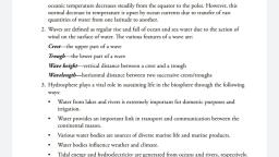
Temperature of Ocean Water, , -< the main source of heat for the ocean, ' é, Te temperature of the surface water in the, a. not the same everywhere., ns, , mperature of the surface water varies with, de. The temperature of water in the high, fes can be as cold as -2°C while in the low, emperatures can be as warm as 36°C., werage temperature of the ocean surface, about 17°C. This temperature generally, es from the equator to the polar areas and, s surface to the deep sea areas., , , , Ocean Circulation, , s continuously moving in the oceans. These, ments cither vertical or horizontal are caused, ious factors such as the difference in, ature and density of ocean water, variation in, and the effect of the prevailing winds., , ree main movements noticed in the oceans, ves, tides and currents., , Waves, , ter in the ocean is continuously moving. On, ace we see water moving in the form of, s. Ocean waves are caused by wind moving, the surface of the water. The friction, cri the air molecules and the water molecules, energy to be transferred from the wind to the, This leads to the formation of waves., , Wave tation, , The upper Part of a wave is called crest and the, lower part is called trough. The vertical distance, between the crest and trough is called wave height, , and the horizontal distance between two crests or, two troughs is called wavelength., , The shape and height of the wave depend on the, speed of the wind. A light breeze produces gentle, waves, while violent and stormy winds create huge, waves which often cause widespread destruction., , Giant waves that sometimes hit the coasts are called, tsunamis., , A tsunami is generated by the displacement of huge, volume of water due to the various tectonic, movements that are caused mainly by earthquakes,, volcanic eruptions or landslides. This massive, movement of water generates huge waves., , With its massive strength, the fast moving tsunami, waves can destroy houses and other buildings in, the coastal areas, say up to a depth of about, 3 kilometres. Ships and large boats can be pushed, by the tsunami waves, several kilometres inland., , yidoing, | Sasneseeamnnncn, , India where there are significant chances of the, occurrence of tsunami., , , , The arrival of the tsunami can be easily detected, with the help of a seismograph., , Tides, , Tides are periodic rise and fall of ocean water level., These are caused due to the combined gravitational, pull exerted on the surface of the Earth by the sun, and the moon. The gravitational pull causes the, oceans to bulge out in the direction of the moon, and the sun. Since the moon is closer, its, gravitational pull affects the ocean more than that of, the sun. The rise in the water level is called high, tide while the fall is called low tide., , Spring and Neap Tides, , Tides do not rise to the same height every day., The relative position of the moon and the sun, with respect to the Earth is responsible for the, , Qo., , Scanned with CamScanner
Page 4 :
variation in the height of tides. There are two, extreme positions., , When the moon is at its first and last quarter phases,, its gravitational pull on the oceans is partially, cancelled by the sun’s gravitational pull. This results, in lower high tides than usual which are called neap, tides., , During full moon (purnima) and the new moon, (amavasya), the Earth, moon and the sun are in, the same straight line and the combined, gravitational pull of the sun and the moon causes, high tides called the Spring tides., , Spring tides, , , , Formation of spring tides and neap tides, , The uses of tides, , 1. During high tide, the water level near the coast, rises. This allows big ships to enter or leave, harbours safely. The ports of Kandla in Gujarat, and Diamond Harbour in West Bengal are, dependent on tidal conditions., , 2. The fishing industry benefits due to tides, enabling fishermen to obtain a bountiful, catch., , 3. Tides are a source of energy. During high tide,, when the sea water gushes in, its energy can be, harnessed and used to generate electricity. Tidal, power stations have been set up in Canada,, Japan and France., , Q., , Ocean Currents, , The water in the oceans is constantly ang”, moving from one part of the ocean to angel, , streams of water are flowing regulary, surface of the oceans in a definite direct, called ocean current. The speed of the), current is about 5 km to 10 km per hour,, , , , , , , , Factors, The various factors that cause ocean curren,, rotation of the Earth, difference in temp, salinity and density of ocean water, planetary, and shape of the coast., , Neap tides, , © Last quarter |, , , , Speed : The ocean currents move swiftly wit, speed of movement of water varying from abou, 10 km per hour. At some places the surface, moves at a slower speed. Broad, slow-m, , masses of water are called drifts. h, Kinds y, , classified into two types—warm currents, cold currents, The difference in tempeM, between warm and cold currents is only 4”, degrees. Warm currents flow from the equ!", region towards the polar regions while cold curt, flow from the polar regions towards the equal, region. Thus, the temperature of current dep*, on where it originates., , On the basis of temperature, ocean “re, , —, , Scanned with CamScanner
Page 5 :
Ocean Currents, , nts of the Pacific Ocean, , : North Equatorial Current, North Pacific, nt, Kuroshio Current, South Equatorial, and East Australian Current., , California Current, Oyashio Current, West, Drift and Peru Currrent., nts of the Atlantic Ocean, , : North Equatorial Current, Gulf Stream,, Atlantic Drift, South Equatorial Current and, tan Current., , 3 Labrador Current, Greenland Current,, ries Current, West Wind Drift, Benguela, ft and Falkland Current., , ‘ents of the Indian Ocean, , N 7 on 3, nm: North Equatorial Current, Monsoon Drift, ranges direction from season to season), South, “orial Current and Mozambique Current., , Li New Wind Drift and West Australian, ent,, , |, rence of Ocean Currents, , eal » sia 5, , ba currents regulate global climate by, , dite the uneven distribution of solar, ‘on reaching Earth's surface., , ROY emma = =, , Zs, , 3., , There is plenty of phytoplankton (fish food), where warm and cold currents meet making ita, rich fishing ground., , Meeting of warm and cold currents leads to, heavy condensation resulting in intense fog., This is a major problem for shipping., , Ocean currents affect navigation. A ship sailing, along a current moves faster, thus saving time, and fuel, while sailing against the current needs, more time and fuel to more ahead., , Warm currents help in keeping the seaport icefree and thus help it to remain open throughout, the year even in higher latitudes., , CASE STUDY, Indian Ocean Tsunami 2004, , Tsunami, , The 2004 Indian Ocean earthquake was an, undersea earthquake that occurred at 00:58:53, UTC on December, 26, 2004 with an epicentre off, the west coast of Sumatra, Indonesia. Its magnitude, was between 9.1 and 9.3 on the Richter scale. It, triggered a series of devastating tsunamis along the, coasts of many landmasses bordering the Indian, Ocean,, , Scanned with CamScanner