Notes of STD :-6, Social Science Std-6_Sem-2_SS_Chp-12.pdf - Study Material
Page 1 :
2nd Proof, , Standard, , 12, , : 6 | Social Science, , Understanding the Map, Introduction, , 1., , Tourists can receive information of the tourist destinations by reading different maps. ( or )( ), , 2., , GPS means _______________ ., , (A), , (A) Globe Positioning System, , (B) Globe Private System, , (C) Globe Private System, , (D) Good Privacy Service, , 3., , The globe of the earth is useful to study the whole earth. ( or ), , ( ), , 4., , What will be more helpful to study about Patan city of Gujarat ?, , (B), , (A) Globe, , (B) Map, , (C) Pictures, , 5., , Why are maps more useful than a globe?, , A., , Because of the following reasons maps are more useful than a globe:, , (D) All of them, , Maps can show more details., Many maps when put together make an atlas and show various continents, countries and can, , provide information about any particular aspect., Maps can be drawn in small scale as well as in large scale., Maps can be folded / rolled and are easily portable., , 6., , Mappa Mundi is a word of the Latin language.***, , 7., , The word map is derived from the Latin word Mappa Mundi., , 8., , What is the meaning of ‘Mappa Mundi’ ?, , A., , The meaning of ‘Muppa Mundi‘ is the piece of cloth that can be held in the hand., , 9., , What is a map ?, , A., , A drawing of the earth’s surface or any one part of it on the plain flat paper is known as a map., Atlas Map, , 10., A., 11., A., , What is an Atlas ?, An atlas is a collection of maps showing various details of earth or its one part., What details does an atlas contain ?, An atlas contains political, administrative, natural and cultural details., , 12., , Map shows physical details like mountains, plateaus, plains, rivers, lakes, etc., , 13., , Transportation and industries are the cultural details that can be shown in a map. ( or ) ( ), , 14., , Transportation, industries, farming and irrigation are shown in the cultural map. ***, , 15., , Oceans are shown in the cultural map. ( or )***, I am ‘Confident’... I am a Change Maker., , ( ), 45
Page 2 :
2nd Proof, , Chapter 12 : Understanding the Map, Types Of Map, 16., A., 17., A., , How many types of maps are there ?, There are two types of maps : (1) Thematic map and (2) Scale Based map., Write the types of Thematic maps.***, Thematic maps are categorized into two main sections based on the natural and cultural details, depicted in them – Natural maps and Cultural maps., , 18., A., , What are scale based maps?, Map that shows physical details is called scale based map. It shows natural landforms like mountains,, plateaus, plains, rivers, oceans etc. This type of map also shows details of wild animals, vegetation,, forests, minerals etc., , 19., , Mountains, plateaus are shown in ______________ map., (A) Political, , (B) Climate, , (C) Topographic, , 20., , Wild animals and vegetation are part of the physical maps. ( or ), , 21., , What details are shown in the topographic map ?, , A., 22., , 24., A., , (D) Historical, ( ), , Landscapes like mountains, plateaus plains, waterways etc. are shown in topographic maps., Which of the following details is shown in the climate map ?, (A) Rainfall, , 23., , (C), , (B) Wind, , (C) Temperature, , Which map is used to show the information about celestial bodies ?, (A) Topographic map, , (B) Industrial map, , (C) Astronomical map, , (D) Cultural map, , (D), (D) All of them, (C), , Write a short note on a scale based map., Map that shows physical details is called a scale based map. A scale based map displays natural, landforms like mountains, plateaus, plains, rivers, oceans etc. Maps showing the details of wild, animals, vegetation, forests, minerals etc. are part of scale-based maps. It can be of three types., (1) Topographic Map : Landscapes like mountains, plateaus, plains, water ways, etc. are shown, in this type of map., (2) Climate map : This type of map focuses on the details of climate, temperature, rainfall, winds,, etc., (3) Astronomical Map : Information about celestial bodies like planets, satellites, galaxies, stars, (constellations) etc. are shown in this type of map., , 25., A., , What is meant by cultural maps ?, The map which outlines the man made details is called a cultural map. This map outlines various, human activities. The map of the state, farming, population, transportation are the examples of, cultural maps., , 46, , I am ‘Confident’... I am a Change Maker.
Page 3 :
2nd Proof, , Standard, 26., , Cultural map outlines various human activities. ( or ), , 27., , Man made details are shown in cultural maps., , 28., , In which map details of farming, population, transportation, etc. are shown ?, , 29., A., , : 6 | Social Science, ( ), , (A) Topographic map, , (B) Physical map, , (C) Climate map, , (D) Cultural map, , (D), , Which map is called a political map ?, A map which shows the details of a continent, country, local administration and their frontier is, called a political map., , 30., , Industrial map shows the details of the industrial sector and production. ( or ), , 31., , Which details are shown in an industrial map?, , A., 32., A., 33., A., , ( ), , Industrial map shows the details of the industrial sector, phased history of industries, production, etc., What is a historical map?, A map which shows the history of regional and national administration is called a historical map., Differentiate between scale-based maps and cultural maps.***, A map that shows physical details is called a natural map. It shows natural landforms like mountains,, plateaus, plains, rivers, oceans, etc. It also shows wild animals, vegetation, forests, minerals etc., When the map outlines the man-made details it is called a cultural map. This map outlines various, human activities. The map of the state, farming, population, transportation are the examples of, cultural maps., , 34., , Match the following :, A, , B, , Answer, , (1) Astronomical map, , (A) mountain, plateaus, , (1) - B, , (2) Political map, , (B) planets, satellites, , (2) - D, , (3) Topographic map, , (C) industrial sector, , (3) - A, , (4) Industrial map, , (D) continent, country, , (4) - C, , Types Of Maps On The Basis Of Scale, 35., , 36., , Generally, if the scale of a map is _______________ then that map is called a large scale map. ( A ), (A) less than 1 cm : 50 km, , (B) more than 1 cm : 50 km, , (C) less than 1 cm : 10 km, , (D) more than 1 cm :100 km, , Map of which of the following is an example of a large-scale map., (A) Village, , 37., A., , (B) District, , (C) City, , (D), (D) All of them, , What is a large scale map ?, Generally if the scale of the map is less than 1 cm : 50 km then that map is called a large-scale map., I am ‘Confident’... I am a Change Maker., , 47
Page 4 :
2nd Proof, , Chapter 12 : Understanding the Map, In this map 1 cm is equal to 50 km, which is the real distance on the earth. A large scale map shows, more details. District, city or village maps are the examples of large scale maps., 38., , A small scale map shows a large area of the earth’s surface., , 39., , A map showing different continents is a large scale map. ( or )***, , 40., , How many types of small scale maps are there? Name them., , A., , ( ), , There are four types of small scale maps :, (1) Atlas (2) Cadastral (3) Toposheet [Site Map] (4) Wall map., , 41., , State if a physical or political map will be used to show the following details., (1) Districts of Gujarat – Political map, (2) States of India and their capital – Political map, (3) Plains and plateaus of India – Physical map, (4) Forests in India – Physical map, , Components Of Map, 42., , There are three main components of a map.***, , 43., , How many components does a map have ? Which are they ?, , A., , There are three components of a map. These are direction, scale and conventional signs., Direction, , 44., , N, , indicates the North direction., , 45., , If you know the North direction then you can easily decide about the rest of the directions., , 46., , If you stand facing the north direction, then the west direction will be at your right and the east, , 47., , direction will be at your left. ( or ), , ( ), , Which direction will be at your back side if we stand facing the north direction ?, , (C), , (A) North, , (B) West, , (C) South, , (D) East, , 48., , East is the direction of the rising sun., , 49., , If you stand facing the rising sun then that time North direction will be at your left hand side and, South direction will be at your right hand side., , 50., , The North-East direction is called Ishaanya direction., , 51., , The _________________ direction is called Aagneya., (A) South-East, , 52., , (C) North-West, , (D) North-East, , Nairutya means _______________., (A) North-East, , 48, , (B) South-West, , (A), , (B) South-East, , (D), (C) North-West, , I am ‘Confident’... I am a Change Maker., , (D) South-West
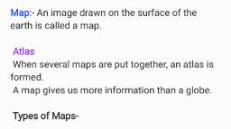
Page 5 :
2nd Proof, , Standard, , : 6 | Social Science, , 53., , The North-West direction is known as Wayavya., , 54., , Any place can be found on a map with the help of directions and intermediate directions. ( or ), ( ), , 55., , Match the following :, A, , 56., A., , B, , Answer, , (1) North-East, , (A) Aagneya direction, , (1) – C, , (2) South-East, , (B) Wayavya direction, , (2) – A, , (3) South-West, , (C) Ishaanya direction, , (3) – D, , (4) North-West, , (D) Nairutya direction, , (4) – B, , Why is the north direction indicated on a map ?, We see the sign, , N, , in every map. This sign indicates the north direction. If we have knowledge of the, , north direction then we can easily decide about the rest of the directions. If we stand facing the, north direction, the south direction will be at our backside, west on the left side and east on the right, side. Thus, any place can be found out with the help of these directions., Scale, 57., A., , What is meant by the scale of a map?, The ratio of the actual distance between any two places on the earth and the distance between, those two locations on the map is called the scale of a map., , 58., A., , If the scale of a map indicates 1 cm = 100 km, what does it mean?, If the scale of a map is 1 cm = 100 km, it means 1 cm on the map is equal to a distance of 100 km, on the earth., , 59., , We cannot use a thread or a scale to measure the distance between two places on a map. ( or ), ( ), , 60., , Mention the types of maps on the basis of scale. Give two examples of small scale maps. ***, , A., , The ratio of the actual distance between any two places on the earth and the distance between, those two locations on the map is called the scale of a map. There are two types of maps on the, basis of scale., Generally if the scale of a map is less than 1 cm : 50 km then that map is called a large scale map. In, this type of map, a distance of 1 cm is equal to a distance of 50 km on the earth. A large scale map, shows more details. District, city or village maps are the examples of large scale maps., A small scale map shows a large area of the earth’s surface For e.g. maps of different continents are, small scale maps. World maps, country maps, etc. are examples of small scale maps., There are four types of small scale maps (1) Atlas (2) Cadastral (3) Toposheet (4) Wall map., I am ‘Confident’... I am a Change Maker., , 49
Page 6 :
2nd Proof, , Chapter 12 : Understanding the Map, Conventional Signs, 61., A., , What is meant by conventional signs?***, Universally accepted signs which are used in the maps to show various physical and cultural details, are called conventional signs., , 62., A., , What do we use as conventional signs in a map ?, Some letters, colours with different shades, pictures and lines are used as conventional signs in a, map., , 63., , Conventional signs are universally accepted., , 64., , ————— is the conventional sign for a river. ( or ), , ( ), , 65., , ______________ is the conventional sign for a rail route., , (A), , (A), , (B), , (C), , (D), , 66., , ____PS____ is the conventional sign for police-station., , 67., , The conventional signs for a river and a dam on a river are the same. ( or ), , ( ), , 68., , ‘CH’ is a conventional sign used in maps to show which of the following?, , (B), , 69., , (A) Chief Minister’s House, , (B) Circuit House, , (C) Light House, , (D) All of these, , PTO is a conventional sign for post and telegraph office. ( or ), , 70., , 71., , ( ), , is a conventional sign for______________., , (A), , (A) capital of the state, , (B) city, , (C) district head quarter, , (D) capital of the country, , Match the following: ***, A, (1), , B, , Answer, , (A) Post and Telegraph office, , (1) – D, , (B) International - boundary, , (2) – A, , (C) River, , (3) – E, , (4), , (D) Scale, , (4) – B, , (5) PS, , (E) North direction, , (5) – F, , (2) PO, (3), , N, , (F) Police station, 72., , Apart from signs, different physical and cultural details can be shown with the help of different, colours and choropleths. ( or ), , ( ), , 73., , Land-Forms are shown with the shades of brown colour in the map., , 74., , Which colour is used to show water bodies on a map ?, (A) Red, , 75., 50, , (B) Blue, , (C) Black, , Vegetation region is shown with green colour in the map. ( or )***, I am ‘Confident’... I am a Change Maker., , (B), (D) Green, ( )
Page 7 :
2nd Proof, , Standard, 76., , Black colour is used to show the rail route on a map., , 77., , What does red colour indicate on a map ?, , A., , Roadways are shown with red colour in a map., , 78., A., , : 6 | Social Science, , What is the importance of conventional signs in a map ?, Various physical and cultural details are shown in a map with the help of some signs, which are, called conventional signs. Some letters, colours with different shades, pictures and lines are used as, conventional signs in a map. Conventional signs of the map are universally accepted. So it becomes, easy to understand a map in any part of the world irrespective of the language spoken there., , 79., , ______________ colour is used in a map to show areas under agriculture., (A) White, , (B) Brown, , (C) Green, , (D), (D) Yellow, , Location Of India, 80., , India lies in the North-West hemisphere of the earth. ( or )***, , 81., , In which continent is India located ?, , A., , India is located in the south of the continent of Asia., , 82., , India lies in the south of the continent of Asia., , 83., , Match the pairs correctly :, A, , 84., A., 85., , B, , A., , Answer, , (1) To the east of India, , (A) Arabian Sea, , (1) – D, , (2) To the south of India, , (B) Himalayan Mountain Range, , (2) – C, , (3) To the west of India, , (C) Indian Ocean, , (3) – A, , (4) To the north of India, , (D) Bay of Bengal, , (4) – B, , Within which latitudes and longitudes does the mainland of India lie?, The mainland of India lies between 8º4’ to 37º6‘ North latitudes and 68º7’ to 97º25’ East Longitudes., Which latitude passes almost through the centre of India ?, (A) Tropic of Capricorn (B) South Pole, , 86., , ( ), , (C) Equator, , (C), (D) Tropic of Cancer, , Write in short about the location of India on the basis of a map.***, India lies in the north-east hemisphere of the earth in the south of the continent of Asia. The Himalayan, Mountain range is situated in the north of India. The Bay of Bengal is situated in its east and the, Arabian sea in its west. The area of mainland India lies between 8º4’ to 37º6’ North latitudes and, 68º7’ to 97º25’ East longitudes. The Tropic of Cancer passes almost through the centre of India., , 87., A., , How many union territories are there in India?, There are 8 union territories in India., , I am ‘Confident’... I am a Change Maker., , 51
Page 8 :
2nd Proof, , Chapter 12 : Understanding the Map, 88., , Locate the following places in the map of India., (A) (1) Gujarat (2) Gandhinagar (3) Rajasthan (4) Jammu and Kashmir (5) Jaipur (6) Delhi (7) Uttar, Pradesh (8) Odisha (9) Maharashtra (10) Lucknow (11) Mumbai (12) Patana (13) Bhubaneswar, (14) Karnataka (15) Ladakh, , 52, , I am ‘Confident’... I am a Change Maker.
Page 9 :
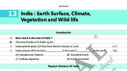
2nd Proof, , Standard, , : 6 | Social Science, , (B) (1) Tamil Nadu (2) Chennai (3) Bengalore (4) Arunachal Pradesh (5) Madhya Pradesh (6) Punjab, (7) Bhopal (8) Meghalaya (9) Mizoram (10) Diu (11) Daman (12) Bay of Bengal (13) Indian, Ocean (14) Lakshadweep Islands (15) Andaman and Nicobar Islands, , , I am ‘Confident’... I am a Change Maker., , 53
 Learn better on this topic