Page 1 : > = Setlary — Bangalore Road. Chatiakere —-S77522, 4 Mob: 81500 42222. 81500 52222., SS E-mail: srsheritageschool.
[email protected], , , , Grade-4 Social Studies, Chapter-5 The Southern Plateau, |. Aural words:, , triangular, include, cultivation, , irrigation, , 1., , 2., , 3., , 4., , 5. electricity, 6. manufacture, 7. industry, , 8., , tradition, , Il. Answer in detail:, 1. What is a plateau?, A plateau is a large area of land that is higher than the surrounding and more or less, , flat at the top., , 2. What landforms border the southern plateau?, The landforms that border the southern plateau are,, e The Aravali Range on the north-west., e The Rajmahal Hills on the north-east., « The Eastern Ghats on the east., , « The Western Ghats on the west., , 3. Parts of which states are included in the (A) Malwa Plateau (B) Chota Nagpur, Plateau, a. Malwa Plateau:, This included the parts of Rajasthan and Madhya Pradesh., , b. Chota Nagpur Plateau:, This included the parts of Jharkhand, Odisha, Bihar and Chhattisgarh., , 4, Name three minerals found in the southern plateau., , The three minerals found in the southern plateau are coal, iron and mica., , 5. Why do most rivers in the Deccan Plateau flow from west to east?, , The rivers in the Deccan Plateau fl ‘om west to east because most of the land of, Edit with WPS Office
Page 2 :
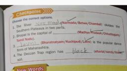
Deccan Plateau slopes from west to east., 6. Why are the cotton and sugarcane grown in large areas of the Deccan Plateau?, Cotton and sugarcane grown in large areas of the Deccan Plateau because there the soil, , is rich in minerals and holds the moisture for longer period., , 7. Many rivers in the southern plateau dry up during summers. Why?, Many rivers in the southern plateau dry up during summers because these are seasonal, , rivers which are fed by rain., , 8. Name three plateaus which form part of the Southern Plateau., The three plateaus which form part of the Southern Plateau are,, « The Malwa Plateau, e The Chota Nagpur Plateau, , ¢ The Deccan Plateau, , FEI III III IOI ITOK,, , Textbook Exercises, , ‘VE Exercises, , A. Fill in the blanks., , 1. High land which is almost flat on the top is called a ., On the north-east border of the Malwa Plateau lie the ZnJ; Hills., , 2:, , 3. The Southern Plateau is divided into two parts by the A/aw mada, Valley., , 4. Plack_ soil found in the Deccan Plateau is very good for cotton., , 5. The Deccan Plateau is bound by the adfaxa_ and Westeun Ghats., , 6. Rice is grown in the Delta _ region of the Krishna and Godavari rivers., , B. Write T for true and F for false sentences., , 1. The Southern Plateau covers a larger area than the Northern Plains. ‘T, , 2. Most of the land in the Deccan Plateau slopes from west to east. ‘T, , 3. The rivers in the Southern Plateau are fed by melting snow in mountains.. F, 4, The rivers in the Northern Plains flow faster than those in the Deccan Plateau. ©, 5, The Central Highlands are very rich in minerals T, , 6. Black soil is good for oilseeds. FY, , C. Match the columns., , 1. Rajmahal Hills a. ArabianSea 4+, , 2. Goldmines * b. Sharavati River 5, , 3. Jog Falls Nofth-8asP'bGrder of Southern Plateau |
Page 3 :
@& Multiple choice questions, , ue, , ui, , The Southern Plateau is bounded on the east and west by, , a. the Aravali Range (b)the hilly regions called Ghats, , c. the Rajmahal Hills d. the Narmada Valley, , Which of these states is not included in the Deccan Plateau?, , @) harkhand _b. Chhattisgarh c. Madhya Pradesh d. Tamil Nadu, Which of these rivers flows from east to west?, , a. Mahanadi __b. Godavari (€)Narmada d. none of these, Dien of these rivers is fed by melting snow?, (a.)Yamuna b. Mahanadi cc. Godavari d, : . Nar, Black soil is especially good for: cotton » pads, a. wheat b. rice c. millets, cotton, , v7) Edit with WPS Office