Page 1 :
Topic: Soil Classification, , 1
Page 2 :
SYSTEMS OF SOIL CLASSIFICATION, Earlier Systems of Classification, • Economic classification: It was based on the economic, use of land and was used by revenue department as a, , basis for taxation, • Physical classification:, , It was based on physical, , characteristics of soils like texture, • Chemical classification:, , It was based on chemical, , characteristics of soils like pH, EC. eg. Calcareous,, acidic, saline.
Page 3 :
• Geological classification: It was based on the under lying, , parent material., ➢Residual/Sedentary- Developed in situ, , ➢Transported – Transportation and deposition of soil, materials, , •, , Physiographic classification: Soils are classified based, on the characteristics of landforms, into basin soils,, valley soils, mountain soils, hill soils, low land soils
Page 4 :
Modern System of Classification, • Dokuchaiev`s genetic system of classification, Classified- based on their own properties and morphology.- Emphasis was, on soil genesis-Zonal, Intra zonal & Azonal, ➢ Zonal soils, It is a group of soils developed under similar climatic conditions and, distributed in a climatic belt. Well developed soil profiles indicating the influence of, climate and vegetation, Eg. Laterite soils, podzol soils, chernozem soils, , ➢ Intra zonal soils, Soils within a particular zone that has got the influence of some local, conditions like topography or parent material are called as intra zonal soils., Eg. Saline soils, sodic soils,, ➢ Azonal soils, These soils have poorly developed horizons because of time as limiting, factor., Eg. Alluvial soils ,Regosols
Page 5 :
• Coffey`s system of classification, He proposed that soils be classified based, on their own properties and he suggested the, grouping of soils into the following 5 classes, – Arid soils, – Dark coloured prairie soils, – Light coloured timber soils, – Black swamp soils, – Organic soils
Page 6 :
• Marbut`s morpho-genetic system of classification, -first attempt towards a multicategoric system of soil, classification., -He established soil profile as the fundamental unit of, study. This system had 6 categories., -At highest categoric level he classified the soils into, pedalfer and pedocals., Pedalfer, Pedocals, o Shows accumulation of, Shows accumulation of Ca, Fe and Al, as CaCO3, o Occur in areas having, Occur in areas having high, high rainfall having surplus, evaporation, having, water for leaching, deficit of water
Page 7 :
• Baldwin and associates genetic approach, ➢ A return to the zonality concept, ➢ more emphasis on soil as a three dimensional body, ➢ Soil Family was introduced, Zonal, , Intra zonal, , 1. Soils of cold zone, 1. Hydromorphic soils, 2. Light colored soils of 2. Halomorphic soils, arid regions, 3. Calcimorphic soils, 3. Dark coloured soils of, semi arid, sub humid, and humid grass lands, 4. Soils of forest grass, land transition, 5. Light coloured podzol, 6. Lateritic soils, , Azonal, No suborder
Page 8 :
Soil Taxonomy- A comprehensive system, • United States Soil Survey Staff of USDA was trying to, arrive at a suitable classification to suit all soils., • Each year starting from 1953 an approximation is, published and circulated., • In 1960, a comprehensive system of classification was, published which is popularly known as, 7thapproximation., • Supplements to this is published in 1964 and 1967., • Finally in 1975, the system was published as Soil, Taxonomy., • It is the official system of soil classification of India.
Page 9 :
• The nomenclature of soil taxonomy is coined, largely from Greek and Latin roots, • Soil Taxonomy was adopted in India in 1969, • The category subgroup was introduced, • Based on measurable soil properties
Page 10 :
Diagnostic Horizons, These are formed as a result of pedogenic processes, and have distinct properties that can be measured in terms of, measurable soil properties. It is of 2 types, 1) Epipedons, 2) Endopedons, , • Epipedons: The diagnostic surface horizons are called as, epipedons., They are the upper most soil horizons and include the, upper part of soil darkened by organic matter, • Endopedons: These are the diagnostic sub surface, horizons., It includes the lower part of soil where soil materials, accumulate
Page 11 :
Epipedons, Greek; Epi- Over/ upon, Pedon- Soil, 1. Folistic Epipedon - Never saturated with water for more than 30, days in normal years, bulk density less than 0.1 Mg/m3, organic, carbon content 8 to 16% depending on clay content., 2. Histic Epipedon - >20-30 % organic matter depending on clay, content and remains saturated with water for 30 days or more during, some season of the year, unless artificially drained., 3. Melanic Epipedon-A thick black colour horizon at or near, but, with in 30 cm of the soil surface and having andic properties. The, deep black colour is due to the accumulation of organic matter, resulting from root residues, supplied by gramminacecous vegetation, result in colour value and chroma of two or less
Page 12 :
4. Mollic Epipedon - A thick, dark colour, soft mineral horizon with, high (>50%) base saturation and strong structure., This epipedon is not naturally dry in all parts for more than, 9 months in a year, value <5 and chroma <3 and n value <0.7., , Contains <1500 mg citric acid soluble P2O5 per kg soil., 5. Umbric Epipedon - A surface horizon like mollic, but is low, (<50%) in base saturation (dominantly saturated with H+) with high, C: N ratio. Not dry for more than 3 months in a year, 6. Ochric Epipedon - A surface horizon that is light in colour. It, , contains less than 1% organic matter and do not qualify for any, other horizon. Dry fore more than 3 months in a year
Page 13 :
7.Anthropic Epipedon - A surface horizon formed due to under, continued system of farming or cultivation that involves large, addition of organic matter (compost). It contains 1500 mg or more, citric acid soluble P2O5 per kg soil., , 8. Plaggen Epipedon - A thick (> 50 cm) man-made surface horizon, produced by a long and continued manuring with sod. It can be easily, identified by artefacts, such as bits of brick, pottery, etc. It also shows, spade marks, 9. Grossarenic Epipedon-A sandy horizon, 100 cm or more thick, , over an argillic horizon.
Page 15 :
Endopedons, Endo- Sub surfece / Deep seated, Pedon- soil, • Argillic Horizon - A silicate-clay-enriched B horizon with clay, skins or clay films formed by Illuviation of clay. The fine clay is, deposited as clay skins or cutans on ped faces and on the walls of, pores., • Natric Horizon - A high sodium-clay-enriched horizon with, columnar and prismatic structure. 15% or more of the exchange, complex saturated with Na+., • Agric Horizon - An illuvial horizon of clay, silt and humus, formed directly under the plough layer due to long and continued, cultivation and it has thickness of 10 cm or more and 5 percent or, more (by volume) wormholes.
Page 16 :
• Spodic Horizon - A humus and /or sesquioxides enriched, subsurface horizon with or without iron. 85% or more of, , spodic materials, • Sombric Horizon- A free - draining horizon and formed due, , to illuviation of humus and not of aluminium or Na., • Cambric Horizon- A colour or structural B- horizon formed, due to alteration by the physical movement or chemical, weathering. Extremely variable in mineralogy because of its, youthfulness, may develop in the presence or absence of, , fluctuating ground water.
Page 17 :
• Kandic Horizon – A subsurface horizon of low activity clays, with or without clay-skins. It has CEC <16 cmol (p+) kg soil at, pH 7 and effective CEC of < 12 cmol (p+) kg soil. It does not, show stratification., • Oxic Horizon - A horizon enriched with Fe- and Al -oxides with, dominance of 1:1 type clay minerals (kaolinite) and from where, , silica has leached., •, , Sulphuric Horizon – A horizon that has pH < 3.5, is toxic to, , plant roots and has yellow mottles of jarosite (KFe+33(OH)6, (SO4)2)
Page 18 :
• Salic Horizon- A horizon with secondary accumulation of water, soluble salts (NaCl, Na2SO4) at some depth in soil profile. Salt, , percentage 60 or more., – 15 cm thick with secondary soluble salt enrichment of over 2%, – Thickness x salt % = 60 or more, – EC x thickness, , = 900 or more, , • Albic Horizon - A bleached E-horizon of podzols and planosols, • Glossic Horizon- A horizon which shows albic horizon characteristics, gradually intruding into an argillic, kandic or a natric horizon and it is, partially altered or degraded argillic, kandic or natric horizon
Page 19 :
• Calcic Horizon - A horizon with secondary Ca-and/or, Mg carbonate enriched materials., • Gypsic Horizon - Calcium and/or magnesium, sulphate-enriched horizon, • Petrocalcic Horizon - An indurated calcic horizon that, has hardness of 3 or more (Moh's scale)., , • Petrogypsic Horizon-A strongly cemented gypsic, horizon whose dry fragments do not slake in water.
Page 20 :
• Placic Horizon -Slowly permeable, dark reddish brown to, black colour Fe or Mn pan that lies within 50 cm of the, surface., •, , Duripan - It is a subsurface horizon at least half cemented by, , SiO2.The air-dry peds do not slake in water or HCl, but are, destroyed by hot KOH after acid washing., , • Fragipan-It is a subsoil layer of high bulk density. It is brittle, when moist, and very hard when dry. It does not soften on, , wetting, but can be broken by the hands. The air dry, fragments slake in water.
Page 21 :
Diagnostic Organic materials, • Fibric (Peat)- Fibrous material constituting over 2/3 of the mass, – Yield clear solution when extracted with sodium pyrophosphate, , •, , Hemic (Mucky peat/ Peaty muck)- Fibrous material- 1/3- 2/3 of, mass, in an intermediate stage of decomposition, , •, , Sapric (Muck)- fibrous material- less than 1/3 of the mass, –, , It produces sodium pyrophosphate extracts with color lower in, value and higher in chroma than 10YR 7/3
Page 22 :
• Humilluvic material- Illuvial humus accumulates after, prolonged cultivation of some acid organic soils, • Limnic materials- Organic or inorganic materials, deposited by the action of aquatic organisms, or derived, , from underwater or floating organisms., Marl, Diatomaceous earth and sedimentary peat
Page 23 :
Diagnostic contacts, • Lithic Contact - A boundary between soil and continuous, coherent, underlying material that has hardness of > 3 on, Moh's scale and through which roots cannot penetrate, • Paralithic Contact - A boundary between soil and, continuous non-coherent, underlying material that has, , hardness < 3 on Moh's scale. The roots can penetrate, at, irregular and infrequent intervals to 10 cm or more, • Petroferric Contact - A boundary between soil and an, indurated layer of iron cemented material.
Page 24 :
• Densic contact- A thick contact between soil and, , densic materials below., • Densic materials- Non cemented, rupture resistance, class. Does not allow root penetration, except through, cracks., • Gelic materials- Mineral or organic materials showing, evidence of cryoturbation- irregular and broken, horizons, accumulation of organic matter generally on, , the top of the permafrost and silt- enriched layers
Page 25 :
Important Terms…, • Cryoturbation (Frost Churning) - It is the mixing of soil matrix, with in a pedon that results in irregular or broken horizons,, accumulation of organic matter over the permafrost table, silt, capping on rock fragments and oriented rock fragments., , • Durinodes - These are weakly-cemented to indurated nodules,, cemented by SiO2, • Permafrost - It is a layer where soil temperature is always < 0°C., , • Plinthite-(Greek, plinthose-brick) - It is a humus poor,, sesquioxides rich horizon. This horizon usually mottled with, yellowish, greyish or white materials., • Tonguing - It is used when albic horizon material penetrates into, an underlying argillic or natric horizon
Page 26 :
➢ n value- It is used to predict degree of subsidence which is, (A-0.2 R)/(L + 3H), A = % of water in the field condition, R = (silt + sand) %, L = clay %, H = organic matter %, ➢ Slickensides - Polished and grooved surfaces developed by, one soil mass sliding over another and common in swelling, clays soils., ➢ COLE (Coefficient of linear Extensibility) – Ratio of, difference between moist length (Lm) at 33 kPa (moisture at, field capacity) and dry length (Ld) to its dry length that is, , Lm-Ld, Ld
Page 27 :
Soil Temperature Regime, These are the range in temperature classes within which, biological activity of different degree prevails. These are of mainly 6, types., • Pergelic : The soil has mean annual temperature lower than 0 oC., • Cryic: Mean annual soil temperature is > 0 oC but < 8 oC., • Frigid : The mean annual soil temperature is < 8 oC The, difference between mean winter and mean summer soil, temperature is more than 5 oC., , • Mesic : Mean annual soil temperature is 8 oC or higher but less, than 15 oC. The difference between mean winter and mean, summer soil temperature is more than 5 oC.
Page 28 :
• Thermic : Mean annual soil temperature is 15 oC or, higher but less than 22 oC. The difference between, mean winter and mean summer soil temperature is more, than 5 oC., • Hyper thermic :Mean annual soil temperature is 22 oC, or higher., • Megathermic- The mean annual soil temperature is 28, oC, If the difference between mean winter and mean, summer soil temperature is less than 5 oC, then a prefix iso, is used before the name of temperature regime., Eg. Iso thermic, iso hyper thermic.
Page 29 :
The temperature range, ie.,important in, determining the degree of biological chemical, activities and physical process going on in soils, is, a. 5-35 °C, b. 10-35 °C, c. 15-40 °C, d. 20-35°C, Ans- 5-35 °C
Page 30 :
Soil Moisture Regime, It refers to the presence or absence of water in a soil at different times of, , the year., Soil- moist- moisture tension of less than 1500kPa (15 bar), Soil- Dry- moisture tension is 1500kPa or more within the SMCS, The limit of SMCS – soil depth to which the soil at wilting point is moistened, when 2.5 cm and 7.5 cm of water are added at the surface.
Page 32 :
Soil Moisture Regime, • Aquic- Saturated for some time in a year-Saturated, • Udic- Not dry for any part for as long as 90 cumulative, days-Leaching, • Ustic- Dry for some or all parts of 90 cumulative days, • Xeric- dry in all parts for 45 or more consecutive days, , • Aridic- Dry throughout for more than 180 cumulative daysNon-Leaching, Ustic- 72%, Aridic- 16%, Udic- 12%
Page 33 :
STRUCTURE OF SOIL TAXONOMY, This system has six categories of classification from the, highest to the lowest level of generalization., • Order, : Highest category in the system, (There are 12 orders), • Sub order : Comparable to great soil groups of the genetic, system., • Great group : A basic category based on diagnostic surface, horizons, • Sub group : Designed to define the central concept of a, great group, • Family, : A practical category for making predictions for, land use plans, • Series, : The lowest and most specific category
Page 34 :
Differentiating criteria used at different levels, • Order, , : Soil forming processes as indicated by presence or, , absence of diagnostic horizons, , • Sub order : Presence or absence of properties associated with, wetness, climatic environment, parent material and vegetational, effects., • Great group : Similar kind, arrangement and degree of, expression of horizons with emphasis on base status, soil, , temperature and moisture regimes, presence or absence of, specific diagnostic features.
Page 35 :
• Sub group: Central concept of great group, There are three kinds of subgroups., ➢Typic is used to define the central concept of great group., ➢Intergrades or transitional forms have properties, intermediate between those of two or three great groups., ➢Extragrades are subgroups that have some properties that, are not representative of the great group but that do not, indicate transitions to any other known kind of soil.
Page 36 :
• Family- Texture, mineralogical class, soil temperature, class and pH are used, • Series- It is the most homogeneous group of soil, taxonomy. Series is a collection of soil individual., Kind and arrangement of soil horizons, color, texture,, structure, consistence, pH, EC and mineralogical, properties of the horizons.
Page 37 :
Soil Orders, • Entisols - These are recently developed mineral soil with no, diagnostic horizon. The main feature of Entisols is a slight degree, of soil formation, because of either limiting time or exceedingly, unfavourable conditions., – Aquents, Fluvents, Arrents, , • Inceptisols - These soils, representing early stage in soil, formation., – Aquepts,Anthrepts,Cryepts, , • Vertisols - These are uniform, soils that have high content (>30, %) of clay. These soils swell on wetting and shrink on drying. The, swell shrink process induces the development of wide, deep, cracks associated with gilgai, microrelief or intersecting, slickensides. Smectite type (Montmorillonite) minerals dominant, in Vertisols and these soils are occur in peninsularIndia, – Aquerts, Cryerts
Page 38 :
• Mollisols - These are soils of grassland vegetation under sub, humid to humid environment., They have dark colour, well developed, base rich (>50 %),, well structured (granular and crumby) surface horizon that is rich in, organic matter., Albolls,Aquolls,Cryolls, • Aridisols - These soils are occur in arid climates and soils dry for, most part of the year and can observe salt accumulation at surface, or subsurface horizon., Cryids, Salids,,Gypsids, • Alfisols - These are base rich soils (> 35 %) with clay enriched, horizon and having evidence of clay illuviation., These soils more strongly weathered than Inceptisols but less, than Ultisols., Aqualfs, Cryalfs
Page 39 :
• Spodosols - These are mineral soils with accumulation of sesquioxides and, humus in the subsurface horizons., -Illuvial horizon, enriched with free sesquioxides (Bs) and humus (Bh), underlying a bleached wood ash-colour eluvial E-horizon., -Formed in cool, humid climate with siliceous parent material, -Aquods, Cryods, , • Ultisols - These soils are more comparable with Alfisols, except for having, low (<35%) base saturation on the exchange complex, which is due to, advance stage of weathering., -Characterized by a clay enriched subsurface argillic or kandic horizon., -Aquults, Udults, , • Oxisols - These are strongly and deeply-weathered mineral soils of the, humid tropics with brick red colour and that are poor in fertility., -Characterized by uniform profile having negligible amounts of, weatherable minerals and are dominated by the kaolinitic and, sesquioxide-rich horizon ., - Can fix more P- due to more sesquioxides, -Also called "Chemically degraded soils”., -Aquox,Udox
Page 40 :
• Histosols - These are organic matter rich (>20 %) soils with peaty horizon, under permanent water saturated environment., -More organic matter addition than decomposition., -They are soils that are by commonly called bogs, moors or peats and, mucks., Hemists,Fibrists,Saprists, • Andisols- These are the soils developed on volcanic ash., -Andisols were first reported in Japan and were named as volcanic, ash material., -They are typically dark colour, with low bulk density, (< 0.9 Mg/m3) due to high content of Allophane minerals soils that do not have, an albic horizon, but must have andic properties, Aquands, Cryands, Ustands, • Gelisols - The order Gelisol is the most recently introduced one., -These soils are show evidence of cryoturbation, i.e. frost churning or, mixing., -Histels, Turbels
Page 44 :
Soils of India, 1. Alluvial Soils - These soils covers largest area in the country, and occupied in the Indo-Gangetic plain, Brahmaputra valley, and Coastal area., • Alluvial soils are rich in plant nutrients (fairly sufficient in P and, K) excepting low in nitrogen and organic carbon contents., • Soils are usually neutral to alkaline in reaction but it may be, acidic in reaction in high rainfall zones like in Assam, (Annual rainfall > 2000 mm)., • The most recent young alluvial soils are called “Khadar” and old, alluvial soils are called “Bhangar”., • Illite is the dominant type of clay mineral in alluvial soils and, these are classified as Entisols, Inceptisols, Alfisols and, Aridisols as per Taxonomy
Page 45 :
2. Black, , Soils (Black Cotton Soils or Self Mulching, Soils) - These are very dark, cracking, clay dominated, soils., • Black soils are locally called as “regur” (Central, India);"karail”(U.P) and “bhaľ(Gujrat)., • Developed from weathered alluvium of Deccan Basalt or basic, parent material under arid, semi arid and sub-humid conditions., • Swell shrink phenomena, deep wide cracks and slickensides are, main features of black soils., • Having high clay varying from 30 - 80 %, high CEC and base rich,, calcareous and pH varies from 7.5 to 9.5., • Black colour of soil due to clay humus complexes and presence of, titaniferrous magnetite mineral., • These soils are classified as Vertisols., • Montmorillonite mineral is dominant type of clay mineral in black, soils or Vertisols and these soils are do not exhibit any elluviation, and illuviation process because of churning process.
Page 46 :
3. Red Soils - These are well drained soils found in semi, arid to warm humid tropical climates., • Developed from granite and metamorphic rocks like, gneisses and schists., • The colour of red soil due to feric oxides on soil, particles rather than high Fe content- red when oxide is, anhydrous (FeO-haematite) and yellow when hydrated, (FeO-OH -limonite)., • The pH of red soils is slightly acidic to slightly alkaline,, low CEC and base saturation, • Kaolinite is dominant type of clay mineral in red soils, and these soils are classified as Alfisols.
Page 47 :
Laterite and Lateritic Soils - These soils are, formed by laterization, • Buchanan - coined the word laterite (Buick red), • These soils are formed in tropical and, subtropical climate with alternate wet and dry, season., • These soils are red in colour, high clay content,, deeply weathered and very deep., • Generally laterite soils having low CEC and low, base saturation (20-40 %)., • Multi-nutrient deficient soils, • Generally laterite soils have vesicular structure., • Kaolinite is the dominant clay mineral of these, soils and is formed due to neosynthesis,, 4.
Page 48 :
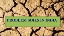
5. Salt-Affected Soils –, • occur in arid and semi-arid climate, • occupy about 6.74 Mha, Soil, Characteristics, , Saline soils, , Alkali or, Sodic soil, , Saline-alkali, soils, , pH, , <8.5, , >8.5, , <8.5, , EC, , >4, , <4, , >4, , .ESP, , <15, , >15, , >15, , SAR, , <13, , >13, , >13
Page 49 :
6. Desert Soils – These are the soils of arid climate, • Generally low in nutrients, very less profile, development and water retention capacity, • Classified as Aridisols, • Illite is dominant
Page 50 :
7. Forest and Hill Soils - These soils are developed under, , forest canopy and generally these soils are found in, Himachal Pradesh, Jammu and Kashmir, Uttarakhand etc., , • "Brown forest soils” under sub-humid to humid climate, • Neutral to slightly acidic, rich in organic carbon,, , moderate CEC (15-25 cmol (p)+ kg, , -1 and, , > 60 % base, , saturated, , • Classified as Mollisols, Inceptisols and Entisols.
Page 51 :
8. Peat and Marshy Soils - High organic matter with, presence of pyrites (FeS2), • Developed under humid climate and occur in localized pockets, of Kerala., • These soils are generally submerged (reduced) but sulphuric, acid is formed when oxidized and soil becomes extremely, acidic (pH < 4)., • These soils are called acid sulphate soils or cat clays, saline, peat soils of Kerala are called “kari” soils (salts + organic, matter)., • Marshy soils are found in tidal swamps in, West Bengal (Sunderbans).
Page 52 :
Lets Discuss Now.., , 52